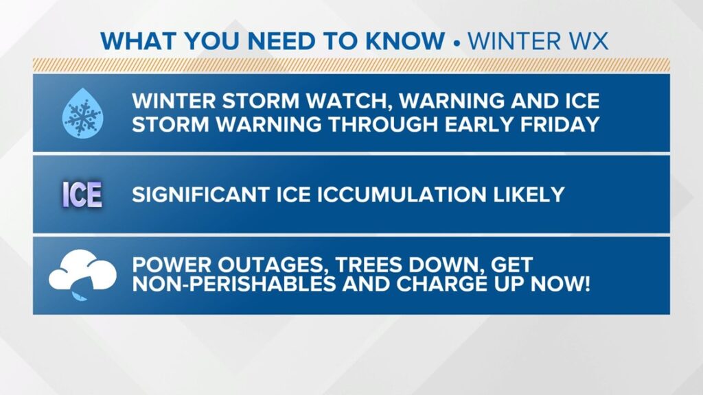
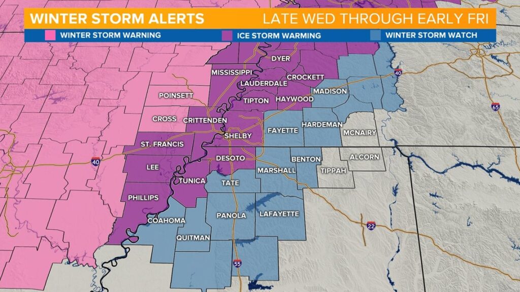
Ice Storm Warnings, Winter Storm Warnings and Watches cover most of the Mid-South through Friday AM
A Level 5 threat for portions of the area as a significant Ice Storm threat is moving in. Prepare now.
By: Chelsea Chandler
MEMPHIS, Tenn —
What you need to know
- Winter Storm Warnings, Ice Storm Warnings and Winter Storm Watches continue through Friday
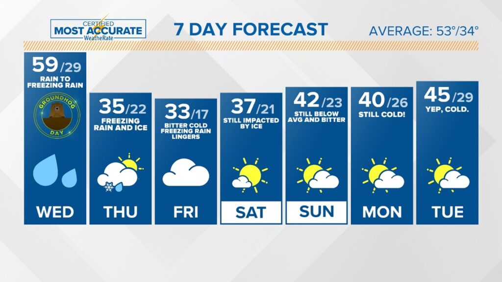
- Rain continues today, transitioning into Freezing Rain later today, continuing into Friday AM. Sleet no longer a big concern. Localized flooding possible for some in our SE counties that are more impacted by Heavy Rain.
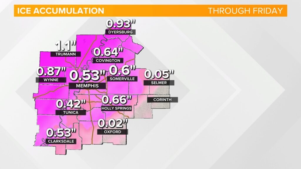
- There is the potential for significant Ice Accumulation, especially in East Arkansas and West Tennessee that would lead to power outages and many downed trees with the potential for over .5″ or more
Today your window is closing…Rain continues on and off today as temperatures fall off quickly and the transition to Freezing Rain begins.
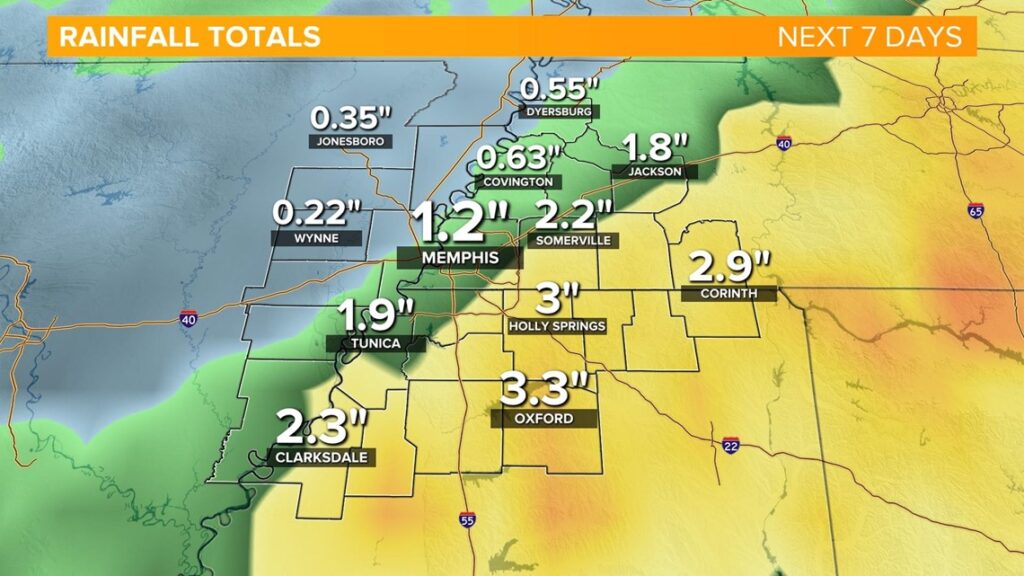
That rain will continue off-and-on into Thursday with the transition to Freezing Rain happening later today. Some of the rain could be heavy at times with some spots picking up an inch or two of rain, possibly even up 4″ in localized heavy areas. This could cause flooding and sets the stage for the next problem.
Winter Storm Warnings, Ice Storm Warnings and Winter Weather Watches cover the area that continue through Friday AM.
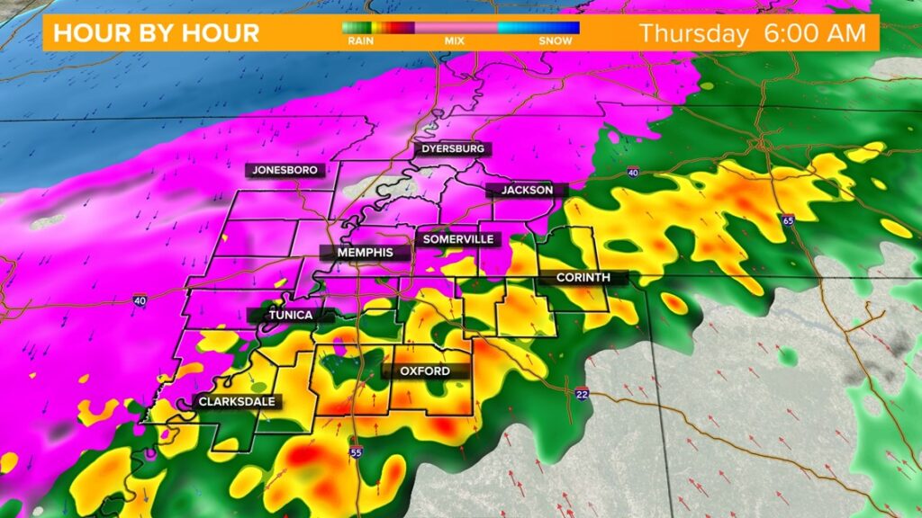
Here is a potential preview of how the radar may look Thursday morning. That is Freezing Rain and Sleet…no fun snow. Maybe a few flurries Friday AM but we will be covered in ice likely at that point so, it won’t matter much.
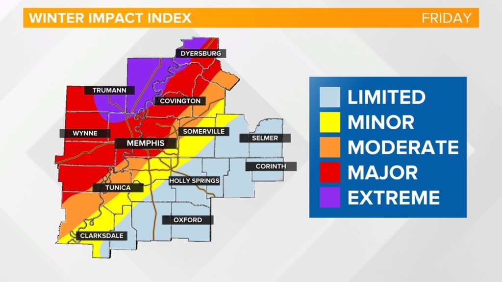
The Winter Storm Impact Index has risen to the highest level-EXTREME. We are looking at the possibility of over .5″ of ice. For perspective .25″ can easily snap a strong power line.
Temperatures will continue to fall with bitter air lingering.